Security scan shows vulnerability regarding this plugin:
]]>This displays a map: [sgpx gpx=”/wp-content/uploads/gpx/2024_08_16.gpx”]
If I want to add the images attached to the post do I write
[sgpx gpx=”/wp-content/uploads/gpx/2024_08_16.gpx attachments”]
[sgpx gpx=”/wp-content/uploads/gpx/2024_08_16.gpx <attachments>”]
or something else? Thanks
]]>https://media.biofit.blog/kolesarske-avanture-v-blejskem-kotu/
[sgpx gpx=”https://myblog.s3.eu-central-1.amazonaws.com/mygpx.gpx” width=”400″ mheight=”300″ mtype=”OSM9″]
or
[sgpx gpx=”https://myblog.s3.eu-central-1.amazonaws.com/mygpx.gpx” width=”400″ mheight=”300″ ]
leaflet.js?ver=1.5.1:5 Uncaught TypeError: Cannot read properties of null (reading ‘0’)
at i._projectLatlngs (leaflet.js?ver=1.5.1:5:79983)
at i._projectLatlngs (leaflet.js?ver=1.5.1:5:80128)
at i._project (leaflet.js?ver=1.5.1:5:79659)
at i._reset (leaflet.js?ver=1.5.1:5:75759)
at i._reset (leaflet.js?ver=1.5.1:5:115735)
at i.fire (leaflet.js?ver=1.5.1:5:5062)
at i._resetView (leaflet.js?ver=1.5.1:5:39147)
at i.setView (leaflet.js?ver=1.5.1:5:27301)
at i.fitBounds (leaflet.js?ver=1.5.1:5:28466)
at Leaflet.CenterMap (WP-GPX-Maps.js?ver=1.6.02:721:14)
I can’t seem to access the support forum or the site demo such as:
https://devfarm.it/wp-gpx-maps-demo/
It gives me a security certificate warning stating:
Your connection is not private
NET::ERR_CERT_COMMON_NAME_INVALID
Seems to do this for all links to the website.
]]>The GPX track used to load fine, but now I get a critical error with 1.7.08. Something in the structure of the GPX file is triggering the error, but I can’t figure out why. The shortcode to the file is [sgpx gpx=”/wp-content/uploads/gpx/skarhamn joined track 220816.gpx”].
The file is edited in Garmin Basecamp. I can upload GPX files from other sources without problems, so the problem must be in the file syntax. But on https://tanndalen.betamed.se the file loads fine with 1.7.05 so something has changed with the update.
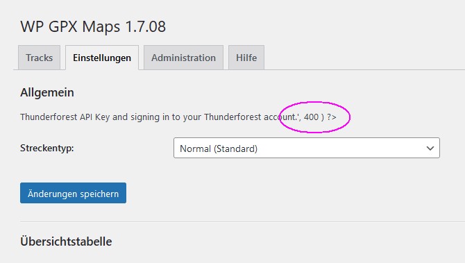
]]>Hi there,
is there some kind of PHP-mismatch in setup options? Can’ t figure out, where to setup my Thunderforest API key.
Thank you.
I have installed 1.7.8 version of WP GPX Maps plugin in the latest WordPress 6.5.4 version.
Is there a way to display satellite map type? (I used ‘mtype=SATELLITE’ in the shortcode before the closing tag, but no-lack)
I tried also the 1.3.7 WP GPX Maps plugins which has a SATELLITE option, but is incompatible with PHP version 7.2 under which I run my test site. It displays a satellite view, but only a map, without any route on the map, neither interactive altitude diagram and with 3 code Warning’s. (“…Invalid expression”, “… Parameter must be an array or an object that implements Countable”, “… Invalid argument for foreach()”) which probably are PHP incompatibility errors.
What if I used the patch on the 1.3.7 version? Would it work ok and display a satellite map, along with altitude diagram?
Appreciate any help.
]]>Hi, Solid Security report a vulnerability :
WordPress WP GPX Maps plugin <= 1.7.08 – Broken Access Control vulnerability
Is there a release plan for this ?
Regards
A majority of the options under the Settings tab are no longer present. I would speculate that this problem was introduced with commits 2970603/3021707 – Update settings variables echo. All variables which use the new “write_row” functions are no longer displayed.
]]>This plugin is working fine for me (WordPress 6.4.3 / PHP 8.2.16 /NextGen Gallery 3.58 non Pro) except for an error stating :
Error When Retrieving NextGen Gallery galleries/images: $eAfter replacing simple quotes by double quote in wp-gpx-maps/wp-gpx-maps-utils-nggallery.php line 119, the error message becomes clearer:
Error When Retrieving NextGen Gallery galleries/images: Exception: No utilities registered forI_Displayed_Gallery_Rendererin /var/www/html/wp-content/plugins/nextgen-gallery/vendor/imagely/pope-framework/lib/class.component_registry.php:860
My guess would be the this error comes from some change in NetxGen Gallery, however it seems to be benign and commenting the line out doesn’t seem to have any negative impact for my site.
]]>So… what is going on? Is it still safe to have the plugin installed?
]]>This plugin no longer functions correctly in PHP 8 due to changes in the min and max functions. If you are able (or are willing) to update the code, you can edit the wp-gpx-maps-util.php file and wrap the problem area in code that checks that the $_ele, $_dist, and $_time arrays exist before applying the functions.
The original code (starting at line 379) is
        $points->maxEle      = max( $_ele );
        $points->minEle      = min( $_ele );
        $points->totalLength = max( $_dist );
        $points->maxTime     = max( $_time );
        $points->minTime     = min( $_time );
This is the updated code
        if (is_array($_ele) && count($_ele) > 0) {
            $points->maxEle      = max( $_ele );
            $points->minEle      = min( $_ele );
        }
        if (is_array($_dist) && count($_dist) > 0) {
            $points->totalLength = max( $_dist );
        }
        if (is_array($_time) && count($_time) > 0) {
            $points->maxTime     = max( $_time );
            $points->minTime     = min( $_time );
        }
Hopefully the original dev will create a new PHP 8 compatible version soon.
]]>Greetings.
I have many maps using your plugin in my website (one example: https://sgowtham.com/journal/2023-grandmas-marathon/ – I used just altitude on the y-axis and distance on the x-axis). When I hover the mouse pointer over this graph, I see the hover text as “3 ft Altitude: 667 ft” instead of “3 mi Altitude: 667 ft”.
Any chance you are willing to fix this in the next version of this plugin? It’d also be great if the distance can be more granular. For example, “3.15 mi Altitude: 667 ft”.
Thank you for your work on this!
Gowtham (G)

Hi,
The only altitude map is showed , but not the Default map type (Thunderforest map, which is selected ).
Neither other type of map is showed.
[sgpx mtype=”OSM2″ gpx=”https://biofitblog.s3-accelerate.amazonaws.com/gpx/zglaze.gpx”%5D
]]>hi,
Plugin does′nt work with php 8.1 und WP 6.2
i tryed also php 8.0, the same … dos not wort and make a critical failure and brokes my site
(Es gab einen kritischen Fehler auf deiner Website.)
the old version 7.4 works fine
have someone the same problem
could it anyone solve?
thanks
I’m seeing A LOT off errors in my logs for WP GPX Maps, hundreds of errors per day, all of the errors are the same thing.
PHP Warning: min(): Array must contain at least one element in /home/xxxxx/public_html/wp-content/plugins/wp-gpx-maps/wp-gpx-maps-utils.php on line 382
Line 382 of wp-gpx-maps-utils.php is
$points->minTime = min( $_time );
My site is a multi user site. I want contributors and authors to use wp gpx map to upload gox too. But i dont want them to access to the admin option menu, is there any way to do this? Thanks
]]>Hi,
is it possible to link waypoints in the map from for example an article, so that I could suggest my readers on a marked waypoint from the text around the map?
regards,
Alex
it no longer works on systems using PHP 8 and hosting company are recommending PHP8
]]>This plugin does not work with PHP 8
the page or post with the map short code will terminate at the short code
and when you try to edit the post or page with the shortcode it will cause a critical error
the only way to edit the post or page is to disable the WP-GPX-MAPS plugin.
Hi!
The problem is, that my server is constantly downloading this three gpx files to server’s /tmp directory. Previous post ore OK.
My short code is
[sgpx gpx=”https://biofitblog.s3-accelerate.amazonaws.com/gpx/camino/ponfetada-trecastila.gpx”%5D
Boris
]]>Hello,
I’m using your plugin because it includes the temperature feature.
The GPX file I’m uploading looks like this:
<trkpt lat="46.317631666666664" lon="7.21032">
		<ele>3178</ele>
		<time>2020-12-14T13:06:51Z</time>
		<speed>18.5</speed>
		<extensions>
			<ns3:TrackPointExtension>
				<ns3:atemp>0.0</ns3:atemp>
			</ns3:TrackPointExtension>
		</extensions>
	</trkpt>
Is this the right way to import temperature?
]]>Is it possible to hide the square and elevation hint in the chart and put point separations for thousands value in the left?
Thank you
]]>I have the problem that as an administrator, I only see my own uploaded files in the overview in the backend, but not those uploaded by other users. How can I change this?
]]>Hello,
I need your help. After I updated WP GPX Maps to version 1.7.05 I am not able to edit many of the pages with the WP GPX Maps short code. Instead of the editing, it brings me a message:There has been a critical error on this website. Please check your site admin email inbox for instructions. And at the same time, I received a message from my web hosting provider with the following information about the error details:
Error Details
=============
An error of type E_ERROR was caused in line 381 of the file /home2/tempdpc6/public_html/wp-content/plugins/wp-gpx-maps/wp-gpx-maps-utils.php. Error message: Uncaught ValueError: max(): Argument #1 ($value) must contain at least one element in /home2/tempdpc6/public_html/wp-content/plugins/wp-gpx-maps/wp-gpx-maps-utils.php:381
Stack trace:
#0 /home2/tempdpc6/public_html/wp-content/plugins/wp-gpx-maps/wp-gpx-maps-utils.php(381): max(Array)
#1 /home2/tempdpc6/public_html/wp-content/plugins/wp-gpx-maps/wp-gpx-maps-utils.php(151): wpgpxmaps_parseXml(‘/home2/tempdpc6…’, ’10’, ‘0’)
#2 /home2/tempdpc6/public_html/wp-content/plugins/wp-gpx-maps/wp-gpx-maps.php(392): wpgpxmaps_getPoints(‘/home2/tempdpc6…’, ’10’, false, ‘0’)
#3 /home2/tempdpc6/public_html/wp-includes/shortcodes.php(356): wpgpxmaps_handle_shortcodes(Array, ”, ‘sgpx’)
#4 [internal function]: do_shortcode_tag(Array)
#5 /home2/tempdpc6/public_html/wp-includes/shortcodes.php(228): preg_replace_callback(‘/\\[(\\[?)(sgpx)(…’, ‘do_shortcode_ta…’, ‘`
Please any advice how I can fix it?
Thanks!
Hello, is there a solution so that the map displayed in the window cannot move or move with the mouse.
Thank you for your help
Hello,
is there any way how I can translate text “Download file” from English? There is now such possibility in backend, only choice to set GPX download. I also tried to do it with Loco translate but without success.
]]>Hello,
I cannot use the short codes with the newest version of the plugin. I tried this:
[sgpx gpx="/path/to/file.gpx" showspeed="false" showele="false" summary="false" summarytotlen="false" summarymaxele="false" summaryminele="false" summaryeleup="false" summaryeledown="false"]
Problem with me or with the plugin?
I am willing to provide any information might be needed about this.
Regards,
Martin
FYI for those that want to use the attachments feature. It doesn’t work in the current version of the plugin. There are some references in the source to $p which doesn’t exist in the function.
I was able to get it to work by making changes to the wp-gpx-maps-util.php file (patch below) and the WP-GPX-Maps.js in the js folder (patch below). Thanks to this post which outlines the js issues (https://www.ads-software.com/support/topic/solution-thumbnails-not-showing-on-map/).
This post combines both fixes.
wp-gpx-maps-utils.php patch in the main plugin folder:
--- wp-gpx-maps-utils.php       2022-02-02 14:31:21.870532444 -0800
+++ wp-gpx-maps-utils.php.bak   2022-02-02 05:56:52.367435802 -0800
@@ -25,16 +25,14 @@
                        $img_src      = wp_get_attachment_image_src( $attachment_id, 'full' );^M
                        $img_thmb     = wp_get_attachment_image_src( $attachment_id, 'thumbnail' );^M
                        $img_metadata = wp_get_attachment_metadata( $attachment_id );^M
-                       $image_file = get_attached_file( $attachment_id, $unfiltered );^M
 ^M
                        $item         = array();^M
                        $item['data'] = wp_get_attachment_link( $attachment_id, array( 105, 105 ) );^M
-                       $item['data'] = str_replace(' alt=','title="' . wp_get_attachment_caption( $attachment_id ) . '" alt=', $item['data']);^M
 ^M
                        if ( is_callable( 'exif_read_data' ) ) {^M
                                ^M
                                try {^M
-                                       $exif = @exif_read_data( $image_file );^M
+                                       $exif = @exif_read_data( $img_src[0] );^M
                                } catch (Exception $e) {^M
                                        $exif = false;^M
                                }^M
@@ -44,8 +42,8 @@
                                        $item['lat'] = getExifGps( $exif['GPSLatitude'], $exif['GPSLatitudeRef'] );^M
                                        if ( ( $item['lat'] != 0 ) || ( $item['lon'] != 0 ) ) {^M
                                                $result[] = $item;^M
-                                       } elseif ( isset( $exif['DateTimeOriginal'] ) ) {^M
-                                               $_dt   = strtotime( $exif['DateTimeOriginal'] ) + $dtoffset;^M
+                                       } elseif ( isset( $p->imagedate ) ) {^M
+                                               $_dt   = strtotime( $p->imagedate ) + $dtoffset;^M
                                                $_item = findItemCoordinate( $_dt, $dt, $lat, $lon );^M
                                                if ( $_item != null ) {^M
                                                        $item['lat'] = $_item['lat'];^M
WP-GPX-Maps.js patch for file in the js subfolder within the plugin folder:
--- WP-GPX-Maps.js      2022-02-02 14:31:08.330594656 -0800
+++ WP-GPX-Maps.js.bak  2022-02-02 09:04:29.542341799 -0800
@@ -880,9 +880,9 @@
                                photos.push({^M
                                        'lat': pos[0],^M
                                        'lng': pos[1],^M
-                                       'name': ngg_span_a.children[0].getAttribute( 'title' ),^M
-                                       'url': ngg_span_a.children[0].getAttribute( 'src' ),^M
-                                       'thumbnail': ngg_span_a.children[0].getAttribute( 'src' )^M
+                                       'name': ngg_span_a.getAttribute( 'data-title' ),^M
+                                       'url': ngg_span_a.getAttribute( 'data-src' ),^M
+                                       'thumbnail': ngg_span_a.getAttribute( 'data-thumbnail' )^M
                                });^M
 ^M
                        }^M
Hi Bastianon,
I’m glad you’re continuing to work on your plugin. Since this was not predictable and your plugin did not run everywhere, I interpret the shortcode sgpx in my plugin.
I have a few comments:
– please change in the readme.txt the line Tested up to: 5.9
– the styles and scripts are still loaded on all pages and not only where they are needed. Therefore, if someone wants to use both your plugin and Leaflet Map, they will need to install the extensions.
Thank you very much.
]]>